This part of The Nordland Trekking Trail is a total of 92.5 km. The journey through this area is characterized by moving from one valley, over a mountainous stretch, and down into the next valley. The highest point on this segment is between Susendalen and Unkervatn, where you reach an elevation of 1065 meters above sea level. This part also features the lowest point of The Nordland trekking trail, located at Unkervatn, which is at an elevation of 321 meters above sea level.
In this segment of The Nordland trekking trail, you will come in close contact with the distinctive mountain Hatten, which has given its name to the municipality of Hattfjelldal. Similarly, to the north, you will be in close proximity to Røssvatnet, Norway's second-largest lake. There is active reindeer husbandry in the southern parts. As a hiker, you have a responsibility to ensure that reindeer or reindeer husbandry is not disturbed. Dogs must always be kept on a leash.
39. section. Raudlia - Famvatnet (15,5 km)
Hiking description
The section starts from Raudlia by continuing southward along the road around Østerbukta in Røsvatnet/Reevhtse. After passing the bay, Nordlandsruta diverges from the road and follows a tractor path further southeast. After a few kilometers, Storelva/Stupheljohke is crossed on a suspension bridge before the trail continues, passing Storfurua. From there, the trail ascends diagonally southwest up the slope through the Storelva-Stillelva Nature Reserve to the pass between Olfjellkleppen (1098 meters above sea level) to the east and Aksla (708 meters above sea level) to the west. From there, the trail follows Tjetterskardet, traverses the slope east of Tjetterskardtjønnen before reaching the top of Austerlia. This is the highest point of the stage at approximately 810 meters above sea level. From there, the trail descends approximately 200 meters down the steep slope of Austerlia before passing between Øvre Skinnfjellvatnet/Bijjie Råavkoejaevrie to the east and Kjelvatnet to the west. The trail continues through gently undulating terrain before reaching the western side of Storbekktjønna and then descending the slope along Storbekken to Famvassveien, where the stage ends. To reach Sivertgården, one must walk along Famvassveien for approximately 2.5 km to the west.
Cultural landmarks along the way can be read about HERE.
Experiences along the way
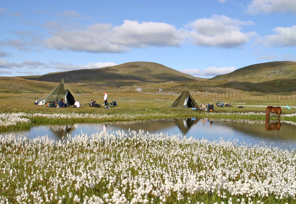
View towards the Okstindan Massif from Kilvassaksla.
Storfurua (A large pine).
40.section. Famvatnet – Krutvatnet (18,2 km)
Hiking description
The section begins where The Nordland Trekking Trail meets Famvassveien from the north, 2.5 km east of Sivertgården. From here, Famvassveien is followed for a total of 5.5 km. On the southwest side of the road, Storslettmyra Nature Reserve and Famvassdalen Landscape Conservation Area are passed, while Raudvatnet Nature Reserve is on the west side. Use this stretch to observe birds and enjoy the fascinating landscape. The trail leaves the road along a tractor road heading west at Brattlitjønnmoen. It then ascends diagonally up the slope through the Favnvassdalen Landscape Conservation Area before circling to the west of Greipfjellet/Kraejhpievaartoe (879 meters above sea level) and then heading southward towards the east side of Fiskløyvatnet/Guelehtsjaevrie. From there, the trail descends gently and passes to the east of Ole Anderson Tjønna, where there is a great lean-to shelter perfect for a rest. Continuing southward, the trail descends the slope towards Krutvatnet before following the north side of the lake to Krutvasshytta. This cabin, owned by Statskog, is open for public use.
Sivertgården, a mountain farm at 530 meters above sea level, where boats can be rented for fishing trout or Arctic char.
41.section. Krutvatnet – Tverrelvnes (21,9 km)
Hiking description
The trail starts from Krutvasshytta and follows the north side of Krutvatnet until it reaches the road at Krutvatn. From here, follow the road south towards the highway between Hattfjelldal and Tärnaby. Continue westward along the highway over Austerelva until the trail branches off southward. Crossing Brundreinbekken on a bridge, the trail follows it on the southeast side until it rounds the east side of Brundreinvatnet/Sarvanjaevrie. The trail then ascends the slope east of Brundreinklumpen/Serviesbaektie (1004 meters above sea level) before reaching Tjyvjodalen, where the river must be crossed. Afterwards, the trail continues on the south side of Mosvatnet/Derfiejaevrie and then Holmatnet/Såålejaevrie, before traversing through slightly undulating terrain and descending the forested slope towards Tverrelvnes and Tverelvnes farm.
Both Mosvatn and Brundreinvatn are good fishing lakes.
The route passes by the characteristic Steinkjerka (Pingkele) at 908 meters above sea level.
Much of the route traverses through Tjuvjodalen among several peaks over 1000 meters high.
42.section. Tverrelvnes – Grannes (12,7 km)
Hiking description
From Tverelvnes, follow the road south towards Sørtjønna for approximately 2.5 km. Just before reaching the lake, the trail veers directly south and crosses Sørelva on a bridge. It then crosses Stormyra and ascends gently on the west side of Storburstinden/Luspievaerie (1023 meters above sea level), rounding the east side of Sæterfjellet (824 meters above sea level) towards the descent into Sandskaret. From there, it descends quite steeply until it meets the highway at the eastern edge of Unkervatnet. Follow the road southeast for a few hundred meters to Grannes and Grannes camping.
If you take the short detour to the summit of Sæterfjellet, you'll enjoy a great view.
About 0.5 km before Sørelva, you can take a short detour to Sørtjønna (Njeeruvenjaavretjh). Here, you'll find two lean-tos and a fishing pier.
43.section. Grannes- Susendalen (24,5 km)
Hiking description
Nordlandsruta's final section is set to change in 2024. This is because the current route traverses calving grounds for reindeer, and the endpoint is far from possible accommodation. Check www.ut.no before starting the section to verify the status. Until the new route is established, you can either hike the old route or choose to hike a new route, but then navigate solely using a map and compass.
Existing Route
This section starts at Grannes at Grannes camping. Follow the highway eastward for approximately 600 meters. Here, a tractor road/clear trail leads south to a suspension bridge over Skarmodalselva. Once across the river, follow a road westward for 300 meters before the trail ascends very steeply up the slope about 500 meters in elevation gain. At the top, the trail heads southeast, eventually following the Rotvassdraget before passing the south side of Rotvatnet/Råaktjoenjaevrie, which sits at 985 meters above sea level. When the trail reaches the river between Daningen/Daarenege and Bliehrehke, there's a boat available for crossing the river. From there, the trail continues on the south side of Daningen before turning southward towards the road in Harvassdalen. There is no mobile phone coverage at the endpoint.
New Route Planned to be Completed by 2024
The route passes through Ørjedalen. From Grannes, this is a section of about 20 km. In Ørjedalen, you can stay overnight at Fjellfiolen. From there, you can choose between two alternative routes towards Susendalen. One route goes to Bergum and Møteplass Børgefjell (9 km), and the other to Furuheim and Furuheim gård (11 km).
Description and map for the hike from Grannes to Ørjedal to Bergum can be found HERE.
Description and map for the hike from Grannes to Ørjedal to Furuheim can be found HERE.
Experiences Along the Way:
The route passes between majestic mountains.
In Ørjedalen, you can take a small detour to Pantdalsætre.
The area is heavily used as a grazing area for reindeer. Show consideration.