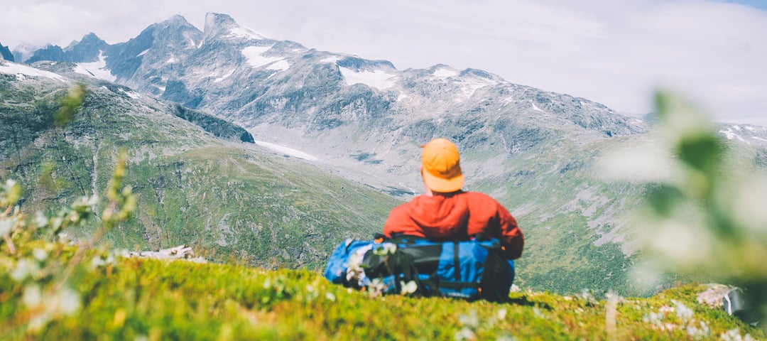
Hiking trip over Hardangervidda - Massiv trail leg 4
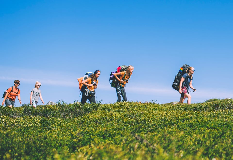
This hike is the final leg on the MASSIF trail. It is a magnificent hike that is suitable for everyone who wants to cross the western part of the Hardangervidda plateau. You get a huge sense of freedom walking in the open landscape on excellent paths.
Publisert: 20. februar 2024
Inspirasjon
Quick facts about the trips over Hardangervidda
Area: Hardangervidda, Skarvheimen
Type: Hike
Classification: Red | Demanding
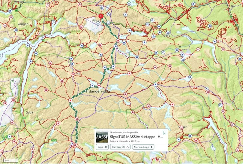
Length and duration: 122,8 km | 6 days | One way, from A to B
Elevation profile: 2724 elevation metres in total.
Season: July - August
The western part of the plateau is more hilly than the eastern part, and Hårteigen can be seen in the distance, which is also known as the ‘waymark in the west’ towering like a hat 1,700 metres above sea level. A beautiful hike that is highly recommended!
Tour description - day by day
Finse/Brebua – Krækkja (24 km)
Follow Rallarvegen (Navvies’ road) to the eastern end of Finsevatnet lake and cross the dam. After a while you come to a path intersection to Blåisen south-west of the dam, and turn south-east across Finsefetene sedimentation flats. Continue up to the south-east across Hansbubekken stream and to the path intersection to Kjeldebu. Continue south-east from here past Store Hansbunuten and Torsteinsvatnet lake, south-east along the western edge of Nordre Midnuten and along Jøkleelva river down to Finnsbergvatnet lake. Walk along the eastern side of the lake and then do a fairly steep ascent up to the south-east. Continue in easy terrain towards Andersbunuten, north of Krobuhalsen, and cross the summer bridge over Svartavassåi river at Larsbu. At the southern end of the Drageidfjord, head down to Krækkja past the path intersection to the cabins Kjeldebu, Halne and Stigstuv just before you come to the lodge.
Krækkja – Stigstuv (20 km)
Follow the path a short distance up along the route towards Finse until you come to the path intersection. Continue up to the south-west through a small ravine and over a summer bridge across the river between the Drageidfjord and Storekrækkja lake, and then up to the path intersection to Kjeldebu cabin. Follow the path up the ravine west of Halnekollen and down a narrow gorge and past the path intersection where there is an unmarked path to the lodge Halne fjellstove. It then goes down to and crosses the Rv 7 road (after approx. 1.5 hours) and then south to the summer bridge across Skulevikåna river. Then follow the path south-west to Lundhaukedalen valley and the path intersection to Dyranut lodge via the Bjoreidalen valley. Continue to the south across the ridge between the mountains Skaupsjøberget and Håsteinreet and past Simletjørna tarn down to the lodge. Stigstuv lodge is privately owned and is one of the most pleasant family-owned lodges on the plateau.
Stigstuv – Sandhaug (23 km)
Walk south-west to Sandhaug lodge, a gem in the heart of the plateau. The path goes west from the lodge in gentle terrain. Walk around the southern side of Endahæ and follow the path on to Falkabu near Langhylen. The path then continues south across Hellehalsen. Cross the all-year bridge between Langavatnet lake and Kristentjørn tarn before the path continues south, across the ridge east of Sjonarhaug and past Reinsmyrtjørna tarn. With Sandhaugnuten to the west of the path, you reach Sandhaug lodge, beside Normannslågen lake.
Sandhaug – Litlos (25 km)
Continue to the south and over two summer bridges across Holmsbustryken between the lakes Nordmannslågen and Laken. Continue west, partly across boggy marshland where walkways have been laid. Over the summer bridge across Besso at the path intersection to Besso lodge and then up on the western side of the river past the lakes Bessevatnet and Bismarvatnet on the western side. Continue up the hillside south of Bismarhei and down Venahallet, across Grotflott and up between Flautenuten and Storahorgi. Then hike along the northern and western sides of Ambjørgsvatnet lake to the path intersection to Hadlaskard cabin, and follow the ravine up between Holken and Småholkane and down to Litlos lodge. The area is known for its rich flora and fish that are eager to bite. And for being far away from civilisation!
Litlos – Hellevassbu (16 km)
West down to the river and across the summer bridge. Continue south along the western banks of Litlosvatnet lake. After a while, continue more to the west up along Fotkjølo river, where there is a summer bridge that you cross. Past the path intersection to Middalsbu cabin and Middalsvatnet lake due west of Prestkona and on south along the foot of the mountain. Then down to the river Kvenno where you cross a summer bridge and south to Vetla Kvenno and over the summer bridge at Søre Belebotnen. There are several hunting shacks here. Past Klerkatjørn tarn and steeply up the ravine west of Velurenuten. Then south from there past a number of small tarns. The path continues south down a steep ravine towards Sigridtjørni tarn. Cross the tarn on the stones at its mouth. Up through Buadalen valley and up steeply, partly on snow into a ravine west of Buanuten. Down towards Øvre Hellevatnet lake and past the path intersection to Middalsbu cabin and along the eastern side of the lake to Hellevassbu cabin.
Hellevassbu – Haukeliseter (21 km)
The last leg of the MASSIF trail is on good paths southwards through hilly terrain. First between Hellevatna lakes, up the hillside to Sudskar, across the river at Simletindvatnet lake and on in hilly terrain across mountain tops and ridges down to Haukeliseter. Haukeliseter lodge belongs to Stavanger Trekking Association and is in a lovely setting. Enjoy dinner and breakfast while admiring the views from its panoramic windows, and dream of hiking further south.
About MASSIV - The Massiv trail
The MASSIV trail is a 350-km-long fairy tale. Whether you do it in one go or in legs over several seasons is entirely up to you. You can spend several days at a cabin and do some of the nice hikes in the area or do longer legs to save time. Irrespective of what you choose, this is a rough suggestion that you can use to plan your tour.
Ut.no is in Norwegian only, but is still useful for English language users. See the route in map, elevation profile, and find more tour facts in the tour description.
Are you looking for a real test of strength? This 350-kilometre-long mountain trail on the rooftop of Norway takes you through the four large mountain ranges of Breheimen, Jotunheimen, Skarvheimen and Hardangervidda.
 About MASSIV - The Massiv trail