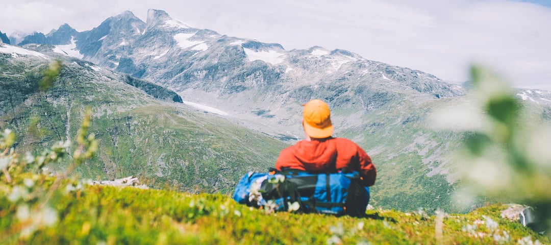
The Breheimen mountains and Jostedalsbreen glacier are located west of the Jotunheimen mountains between the Sognefjord, Nordfjord and Bøverdal valley. The name reeks of snow and ice, and rugged men crossing gaping glacier cracks with ropes, but the area has a lot more to offer. The green, fertile valleys are just as striking as the rugged peaks.
Publisert: 20. februar 2024
Inspirasjon
Quick Facts
Area: Breheimen, Breheimen National Park
Type: Hike
Classification: Red | Demanding
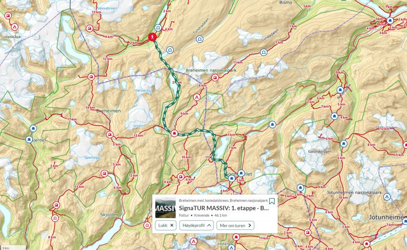
Length and duration: 46,1 km | 2 days | One way, from A-B
Elevation profile: 2794 elevation metres in total
Season: July - September
Route: Sota Sæter - Nørstedalseter - Sognefjellshytta
Breheimen is leg 1 of the MASSIV trail. The adventure starts at Sota Sæter lodge, before you set off to cross Fortundalsbreen glacier, towards the lodges Nørdstedalseter and Sognefjellshytta. You cover 45.5 km in hilly and demanding terrain over the course of the next two days.
Tour description
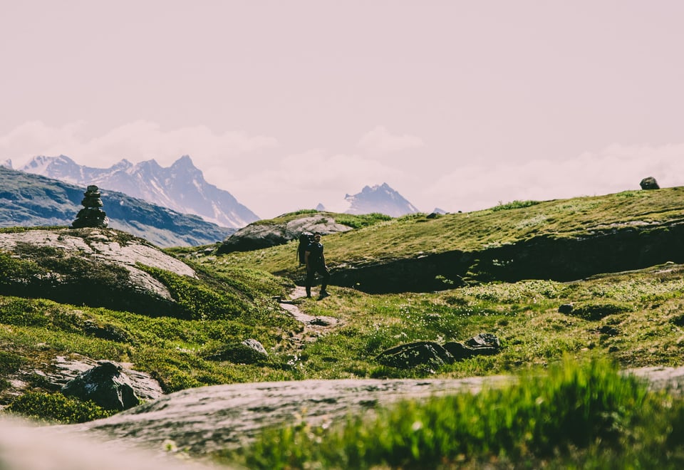
Sota Sæter to Nørstedalseter (24 km)
Get up early and enjoy the delicious breakfast at Sota Sæter before you start the ascent to Illvatnet lake and on towards Nørstedalseter lodge. You can make a packed lunch from the morning’s breakfast buffet. The uphill climbs from Sota Sæter towards Illvatnet lake are the longest on the whole route. You climb approx. 860 altitude metres on this leg, but you should hike steadily so that you don’t run out of energy. If you join a guided glacier walk across Fortundalsbreen glacier, you follow the signs towards the glacier rather than towards Illvatnet lake. You are rewarded at the end of the day by a downhill hike in slightly more gentle terrain. You can enjoy dinner at Nørstedalseter lodge accompanied by a view of one of Norway’s most spectacular valleys, before you head for bed, happy that the adventure has begun.
From Nørstedalseter to Sognefjellshytta (25 km)
The day’s hike is nice and varied. First eastwards up Vetledalen valley and all the way up Tverrbyttfjellet, 1,571 metres above sea level. You then turn south in hilly terrain with glaciers, lakes and peaks everywhere you look. If the weather is smiling, you’ll be able to look across the magnificent Smørstabbmassivet and Fannaråken mountains on the last few kilometres to Sognefjellshytta lodge. Fantastic views of the beautiful Jotunheimen mountains. The lodge is situated on the top of Sognefjellet, 1,400 metres above sea level.
About MASSIV - The MASSIV trail
The MASSIV trail is a 350-km-long fairy tale. Whether you do it in one go or in legs over several seasons is entirely up to you. You can spend several days at a cabin and do some of the nice hikes in the area or do longer legs to save time. Irrespective of what you choose, this is a rough suggestion that you can use to plan your tour.
Ut.no is in Norwegian only, but is still useful for English language users. See the route in map, elevation profile, and find more tour facts in the tour description.
Are you looking for a real test of strength? This 350-kilometre-long mountain trail on the rooftop of Norway takes you through the four large mountain ranges of Breheimen, Jotunheimen, Skarvheimen and Hardangervidda.
 About MASSIV - The MASSIV trail