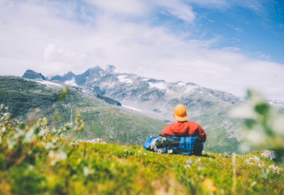
This hiking tour takes you from the magnificent high mountains at Sognefjellet, through the fertile valley of Utladalen with its cascading waterfalls to Hjelle, before the journey continue onwards to the Sognefjord. A unique and breathtaking hiking experience!
Publisert: 05. mars 2024
Inspirasjon
Quick Facts
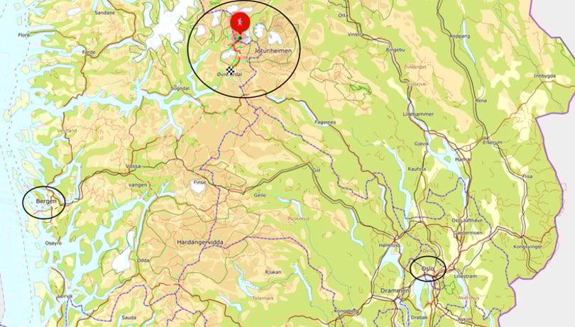
Area: Jotunheimen nationalpark, Utladalen Protected Area
The hike starts at the high mountains near Sognefjellshytta on t-marked trail to Skogadalsbøen lodge set in the green landscape with mountain views. From here the trail continues to Vettismorki, an open summer pasture area with beautiful views of Stølsmaradalen valley, continuing passed Vettisfossen waterfall in all its glory to Hjelle.
Tour description Sognefjellet-Utladalen
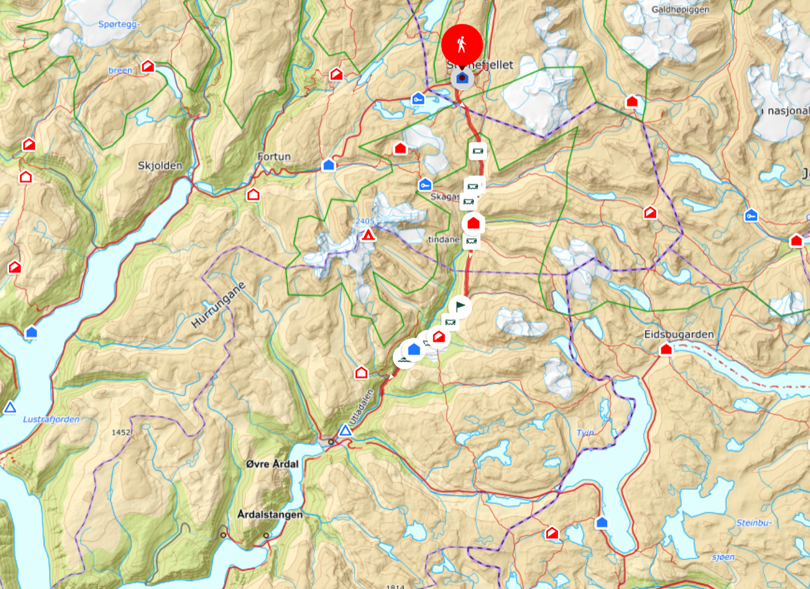
Day 1: Sognefjellet to Skogadalsbøen (13,4 km)
The trail begins at the southern end of the car park at Sognefjellshytta. After approximately 1.5 km, you pass the trail junction to Fannaråkhytta. Continue past Rundhaugstjønne on the eastern side and down to the junction towards Krossbu. Head south into Vetle Utladalen.
You’ll cross Steindøla and Kongsdøla via year-round bridges before reaching Storebrui in Utladalen. Here, you’ll find trail junctions to Fannaråkhytta and Turtagrø on the west side of the river Utla, and to Leirvassbu and Olavsbu on the east side.
Cross the year-round bridge and continue south through lush terrain down Utladalen to Skogadalsbøen. The path is well-marked and relatively easy to walk. Boardwalks have been laid across the wet marsh areas in Vetle Utladalen.
Day 2: Skogadalsbøen - Vettismorki - Hjelle (17 km)
Head south and cross the Skogadøla river via a year-round bridge to the trail junction for Olavsbu, Gjendebu and Fondsbu on the opposite side. Continue to another junction for Fondsbu, Tyinholmen and Koldedalen.
Keep heading south and cross Uradøla via a year-round bridge, passing the unmarked trail down to Vormeli, then climb steeply towards Friken. From here, you’ll enjoy a beautiful view of the Hurrungane mountains.
The trail then descends steeply into Fleskedalen and crosses Fleskedøla via another year-round bridge. Continue through the forest to Vettismorki – this section of the trail runs through steep terrain.
From Vettismorki, the t-marked trail towards Hjelle continues westward via the Vettisfossen waterfall viewpoint.
An alternative route is to follow the southward trail along the Morkaelvi river. After crossing the bridge at Kalvøynhaug, continue along the river on unmarked trail back to the t-marked trail to Hjelle. This is a somewhat shorter alternative, but note that the trail does not pass Vettisfossen waterfall.
The T-marked trail to Hjelle continues southwest for both routes, and the trail eventually descends steeply in many switchbacks down to Vetti Gard. A worthwhile detour to the base of Vettisfossen is available just before reaching Vetti Gard farm – approximately 1 hour round trip.
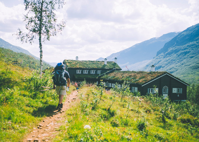
From Vetti Gard, the hike continues on gravel road to Hjelle. From here you can take a bus onwards in the main summer season. Out of season, continue by foot from Hjelle to Øvre Årdal where you can take a bus from Svalheim bru.
Ut.no is in Norwegian only, but is still useful for English language users. See the route in map, elevation profile, and find more tour facts in the tour description.