This segment of The Nordland trekking trail is a total of 48.5 km. It can be hiked as two separate trips:
Umbukta - Kjennsvatnet
Kjennsvatnet - Raudlia.
The journey starts in gently rolling terrain along a series of regulated lakes. It concludes through Spjeltfjelldalen and the Spjeltfjelldalen Nature Reserve. The highest point on this section is between Gressvatnet and Kjensvatnet, at 860 meters above sea level. The lowest point of the section is at the starting point in Raudlia (391 meters above sea level).
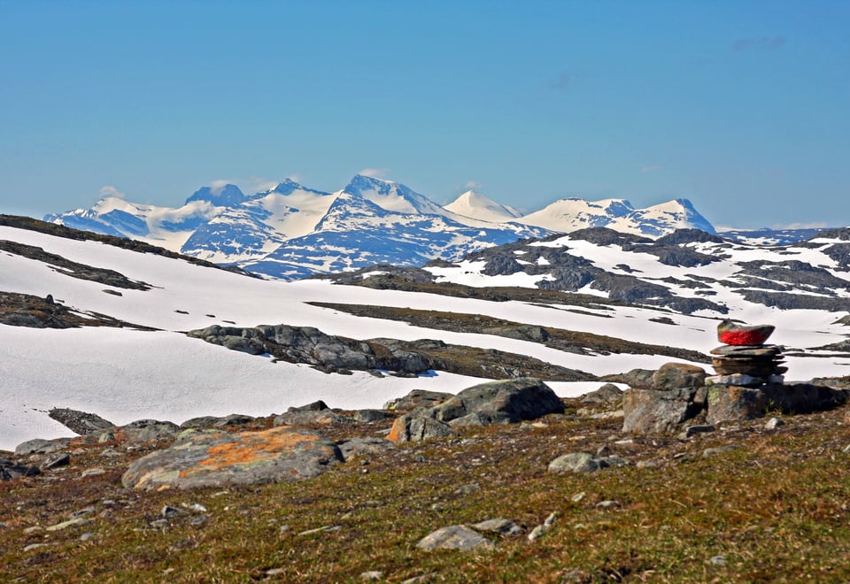
In this part of the The Nordland trekking trail, you'll come in close proximity to the Okstindmassivet with glacial arms and Northern Norway's highest peak, Oksskolten (1916 meters above sea level). There is active reindeer husbandry in the area. As a hiker, you have a responsibility to ensure that reindeer or reindeer husbandry is not disturbed. Dogs must always be kept on a leash.
36. section. Umbukta - Kjennsvatnan (22,5 km)
Hiking description
The trail starts at the end of the parking lot on the south side of the highway. From here, it traverses gently undulating and somewhat marshy terrain southwestward on the north side of Vesterbukta in Uman before veering westward and passing the south side of Mølntjønna. After crossing the lake, the trail turns southward, passing to the east of Holmtjønna. From there, it continues southward along the west side of Rundfjellet (815 meters above sea level) until it reaches the east side of Grunnvatnet. Here, Grunnvasskardet is crossed, and the trail ascends the slope on the west side of Skukken/Skoehtehkevaerie (857 meters above sea level). Litjskardet is crossed, and the trail turns westward, following the base of the mountain and passing to the north of Gresfjellet (1407 meters above sea level). Grasfjellkoia, an open emergency shelter, is passed here. The trail continues westward before turning southward through Storskardet and descending the slope toward Austre Kjennsvatnet. From there, the road is followed southward and westward. The Nordland trekking trail branches southward onto a trail after approximately 1 km, but if you are staying at Kjensvasshytta, you must continue along the road for about 2 km more.
There are numerous Sami cultural heritage sites in the area.
Skukkenrøysa Riksrøys 218; Riksmerke 271, built in 1761, is only a few hundred meters from the trail.
Evidence of settlement from the Neolithic period has been found in the area.
In Storskardet, you can see traces of bombs dropped there during World War II.
37. section. Kjennsvatnan - Gresvatnet (7,4 km)
Hiking description
Here, two alternative routes can be chosen:
Route 1 follows the construction road eastward and up to Gresvatndammen. From there, the trail follows the edge of Gresvatnet/Graesiejaevrie for most of the way. Approximately 2 km before Gressvasshytta, the trail ascends from the water's edge, crosses the foot of a peninsula, then crosses Oksfjellelva on a bridge, and finally follows the shoreline to the cabin. This route is not recommended when water levels are high.
Route 2 starts southward from the construction road about 2 km east of Kjensvasshytta. Here, the trail ascends steeply over 300 meters in elevation before reaching the pass and rounding the west side of Ridaren (1065 meters above sea level). It then slopes down the south side of the mountain with Bretjønna to the south and follows the north side of Oksfjellelva down toward Gresvatnet. Here, the two route alternatives converge, and the trail continues southward on a bridge over Oksfjellelva, following the shoreline to the cabin.
At Kjensvasshytta, a rowboat is available for use, and a wood-fired sauna can be rented.
Kjennsvatnan is a great starting point for a hike to Oksskolten (1916 meters above sea level) and Okstindbreen.
Trail to Rabothytta from Kjensvasshytta is approximately 10 km.
From Kjensvasshytta, it's about 9 km down to the road in Leirskardalen.
38. section. Gresvatnet - Raudlia (18,6 km)
Hiking description
The trail starts southward and along the western side of Spjeltfjelldalsbukta before entering the beautiful Spjeltfjelldalen/Spielhtebåvloe with the Okstindmassivet to the west. The trail crosses the valley through marshy terrain before ascending gently to the pass between Spjelthaugen (790 meters above sea level) to the west and Ryphaugen (912 meters above sea level) to the east. Here, you reach Balskåta. From there, the trail continues southward, crossing Skrikarbekken before gradually ascending the slope towards Artfjellet/Aertegevaerie (1055 meters above sea level). Following the mountain ridge downwards and westwards towards Spjeltfjelldalselva, the trail stays on the east side of the river until reaching the road at Granheim. The road is then followed southward for about 1 km until reaching Raudlia. If you're planning to stay overnight at Stekvasselv gård, you'll follow the road for approximately 2 km westward from Granheim.
The route passes along the majestic Okstindene with Northern Norway's highest mountain, Oksskolten, at 1916 meters above sea level.
Spjeltfjelldalskøta has Sami origins but is now maintained by Statskog. The cabin was last restored in 1991.
The route passes through the Spjeltfjelldalen Nature Reserve, which is protected to preserve a productive high-altitude wetland area of great regional conservation value, particularly due to its rich and varied birdlife.