Segment 2 On the boarder
From Sijdasjávrre to Vájsáluokta
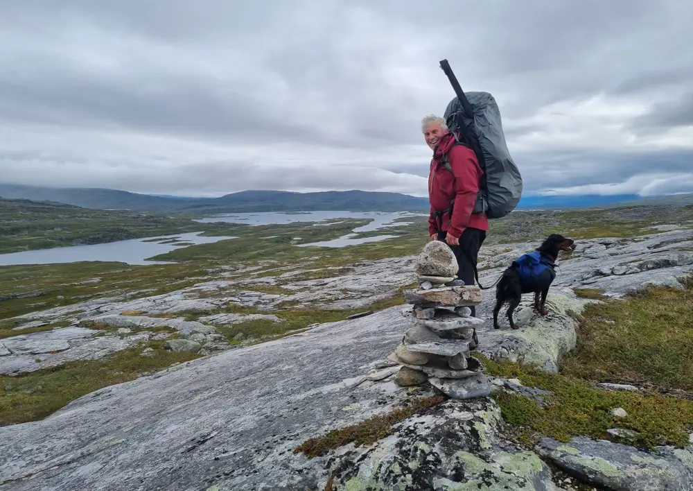
This segment of the The Nordland trekking trail is a total of 104.6 km. The journey starts from Sitashytta and goes south on the Swedish side of the border, but makes detours to Paurohytta and Røysvatnhytta on the Norwegian side of the border. Further on, the route winds south between mountain peaks and mountain lakes on the Swedish side of the border, reaching Njallajávrre. From here, the route heads directly east, following the southern side of Såtgåjåkha, and eventually reaching Akkajaure and Vájsáluokta. This part of the The Nordland trekking trail mostly traverses high mountain terrain at an altitude between 600 and 800 meters above sea level.
At Njallajávrre, there are no cabins, but the Hellmobotn landowner association has set up shelters 2-3 km into the Norwegian side that can be used.
Hiking description:
9. section. Sijdasjávrre - Båvrojávrre (21,8 km)
Hiking description:
The path from Sitashytta follows the gravel road northwest to the western end of Sijdasjávrre. Here, the river between Sijdasjávrre and Forsvatnet is crossed by a bridge. From the end of the gravel road, the path follows the power line in a southwest direction. The path rounds south of Filtinden (1311 meters above sea level) before turning southward in hilly mountain terrain and descending to Baugevatnet. The path follows the northeast side of the lake until reaching Baugebua at the very eastern end. Baugebua has 2 bed spaces. At Baugebua, there is a bridge over the inlet stream to Baugevatnet. The stream is followed upward on the southwest side before rounding Paurofjellet to the west while simultaneously making a turn into Sweden. The path then reaches Båvrojávrre and follows the north side of the water to Paurohytta.
You can see a map of the stage HERE.
Experiences along the way:
- Hiking in borderland.
10. section. Båvrojávrre - Røysvatnet (26,7 km)
Hiking description:
The trail begins at the narrow peninsula extending southward into Båvrojávrre. A bridge (constructed in 2019) spans the strait, allowing for dry passage to the peninsula on the south side of the water. The peninsula is crossed, and there's a bridge over the strait at the east end of Noaidejávri. Continuing eastward, the trail reaches the southeast end of Båvrojávrre, approximately where it crosses the border into Sweden. Just under 100 meters south of where the trail crosses the border stands Noaiderøysa; border cairn 252. The trail then descends towards the southwest side of Kåbtåjaure/ Gåbddåjávrre and follows the water to the southern bay. From here, the trail heads southward and up the slope to the watercourse that rounds the south side of the mountain Skuogertjåhkkå (1485 meters above sea level). The three lakes Spadnejávrre (700 meters above sea level), Skuogejávrre (629 meters above sea level), and Svártijávrri (687 meters above sea level) are followed on the south side. The outlet of Skuogejávrre is crossed by bridge. From Svártijávrri, the slope is followed westward over the summit and down to Bjørnvatnet/Biernajávrre (800 meters above sea level). Røysvatnhytta is located at the outlet of the lake.
You can see a map of the stage HERE.
Experiences along the way:
- Hiking in two countries.
- Hiking along six large mountain lakes.
- The area is summer pasture for reindeer.
11. section. Røysvatnet - Njallajávrre (24,8 km)
Hiking description:
The trail from Røysvatnet to Njallajàvrre is well marked with cairns, but the path can be somewhat difficult to discern in the terrain at times. From Røysvatnhytta, the Nordlandsruta heads southwest along the heights north of Røysvatn before crossing the border and rounding the slope west of Sårgåsjávrre, finally descending to the western inlet river of the lake. Here, the river must be forded. The trail then ascends the slope until it crosses the border between the municipalities of Gällivare and Jokkmokk. The river Rikkeskjåhkå runs along the border and must also be forded. Rikkeskjåhkå can be very challenging to ford during snowmelt and has high water flow until the latter half of July.
The route then continues up the slope and into the small lakes east of Jiegnajávrás. This area features rocky terrain with sparse vegetation. From here, the trail ascends a steep slope to a lake at an altitude of 656 meters, where the inlet river must be forded as it flows into the lake. From this point, the trail continues at the same altitude along the slope east of Skáddevárre (1113 meters above sea level). Here, there is a good view of the landscape to the east.
The final part of the trail descends the southeastern ridge of Skáddevárre and towards the valley bottom. Approximately 1 km before reaching Valldajåhkå, the trail veers 90 degrees west and follows the northern edge of a marshy landscape for about 1.5 km until reaching the bank of Valldajåhkå. The river must be forded. From the south side, the hiking trail follows the southern bank of the river to Njallajàvrre. There are no cabins at Njallajàvrre. However, from here, there is a marked trail across the national border towards Hellmobotn. Approximately 3 km from the border, the Hellmobotn landowner association has built a shelter cabin that is open and can accommodate 3 people.
You can see a map of the section HERE.
Experiences along the way:
- Hiking in two countries
- Fording across 4 streams/rivers
- The area is summer pasture for reindeer
- Views over the Swedish mountain world
12. section. Njallajávrre - Vájsáluokta (31,3 km)
Hiking description:
This section begins on the Swedish side approximately 1.7 km from the national border. If you stay overnight in the shelter cabin at Nuortakrågge, you must walk back to the trail junction here. Follow the trail that ascends the slope towards the southeast. From here, continue along the foot of Rautåive/Rávdoajvve for about 17 km until reaching the small rest cabin at the northwestern end of Rávddajávrre. The rest cabin lacks a kitchen and heating but serves well for overnight stays if you have a sleeping bag. The trail to the cabin runs south of Valldajåhkå, with bridges built over crossing streams and rivers. The first part traverses open mountain terrain, while the latter part passes through mountain birch forest.
From the rest cabin, the trail follows the north side of Rávddajávrre, crosses the outlet on a bridge, and continues until reaching the bank of Akkajaure/Áhkájávrre. Here, two rivers are crossed on bridges, and then the trail follows along the water until reaching Vájsáluokta. The final part of the trail passes through dense birch forest on somewhat rocky terrain.
You can see a map and more information about the section HERE.
Experiences along the way:
- You can enjoy the sight of grazing reindeer
- Views over the large inland lake Akkajaure
- Hiking from open high mountain terrain to mountain birch forest
- Experiencing Valldajåhkå as it meanders through the marshy landscape towards Akkajaure
Private accommodations
Gammen i Nuortakrågge
Vájsáluokta Fjällstuga
Accommodations DNT
You will find links below the article to the cabins owned by the Norwegian Trekking Association (DNT).
Accommodations DNT
Se også


