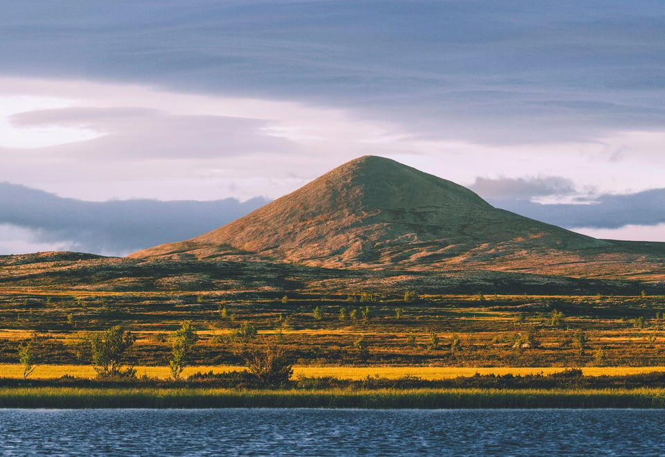
SAGA is DNT’s route from Lillehammer to Snøhetta mountain, 220 km across the Ringebufjellet mountains, and through the Rondane and Dovrefjell national parks. The route follows the Norwegian Trekking Association's marked trails, with accommodation in staffed lodges and self-service cabins.
Publisert: 04. mars 2024
Inspirasjon
About SAGA
From the route in the south taken by the supporters of King Sverre with the young heir to the throne Håkon Håkonsson, to the magical Snøhetta mountain in the north. From Peer Gynt and the Hall of the Mountain King in Rondeslottet mountain, to the oath sworn to the Norwegian constitution – ‘United and loyal until the mountains of Dovre fall’. The route takes you on an historical and mythical journey.
Tour description – summer
A 220-km tour across the Ringebufjellet mountains and through the Rondane and Dovrefjell national parks. The route follows the Norwegian Trekking Association's marked trails, with accommodation in staffed lodges and self-service cabins. The tour takes you on an historical and mythical journey – from the route taken by the supporters of King Sverre with the young heir to the throne Håkon Håkonsson, to the magical Snøhetta mountain in the north.
More and more people want to go on long hikes in the wilderness, away from the hustle and bustle of everyday life. Come and create your very own SAGA!
Stage one: The Ringebufjellet mountains
Day 1: Nordseter (Lillehammer) – Pellestova Hotel, via Nevelfjellet, 7.2 km, about 3 hours and 30 mins
From Nordseter activity centre/bus stop, walk over to Grøtåssetervegen just west of the large car park between the activity centre and Lillehammer mountain lodge. Follow the road about 400 metres north-west, then continue on the trail over the marsh, along the wooded hillside, and up to Neveloset, where the river Nevla flows from Nevelvatnet lake. The terrain is initially marshy and rocky in places. The route has significantly improved since walkways were laid in recent years. From Neveloset, there’s a wide trail through a sparse forest, that eventually turns into bare mountain. Take the steep incline up to Nevelfjellet mountain (1,092 m.a.s.l.). The Uværsbua shelter was restored in the summer of 2021 by Gropmarkas Venner. Stop at the orientation table to identify the names and distances to a number of peaks in Jotunheimen and Rondane. From the top of Nevelfjellet mountain, head north-west down the hillside to Hundersetra pasture farm and then up the hill to Pellestova Hotel.
Day 2: Pellestova – Djupslia cabin, 24.6 km, about 7 hours
The trail starts just east of the junction below the hotel and continues down to and around Malmtjønnet lake. There’s a short incline from here up to where you cross Pellevegen road. A good and well-defined trail continues north on the western side of Reinsfjellet mountain and crosses the bridge over Hitbekken stream, then leads up between the mountains Hitfjellet and Veslefjellet. The trail crosses the Lie-Hornsjøvegen road at Sjøsetra pasture farm and leads between the farms, up the hill, in the direction of Snauskallen mountain. Continue past the farms Gullbringen, Vedemslia and Brettdalen, over the ridge, down to the west end of Djupen lake, and over the dam. Continue up the farm track, eastwards past Djupslia pasture farms to the DNT cabin on the hillside, about 100 metres below/south of the farm track.
Day 3: Djupslia – Vetåbua cabin, 17 km, about 5-6 hours
There's a good 100-metre ascent up Åstkyrkja, before the route heads down into the forest, with streams and some places that are wet underfoot. After 5 km, you arrive at Tauteren, where there’s another ascent and bare rocky terrain. The 7-km route over Gopollfjellet mountain takes you about 1,100 metres above sea level in gentle and varied terrain. Once down below the treeline, you're back in familiar marsh terrain. It’s a 4-km hike from the foot of the mountain to Vetåbua cabin (925 m.a.s.l.).
Day 4: Vetåbua – Jammerdalsbu cabin, 21 km, about 6-7 hours
Today’s first 5 km are through white-birch forests, over marshes and diverging rivers. The trip continues in bare rocky terrain up and over the highest point of the trip so far: Øverlihøgda, which is 1,170 metres above sea level. There’s a steady descent down to Saubu cabin, before the final ascent to Jammerdalsbu cabin (1,130 m.a.s.l.). The cabin is wonderfully located between the peaks of Jammerdalshøgda and Langtjønnshøgda.
Day 5: Djupslia – Veslefjellbua cabin, 18 km, about 5-6 hours
Today’s route is part of the Rondanestien Trail. From the cabin, head gently down the west side of Jammerdalshøgda to Friisvegen road (20 minutes). Cross the road, continue around Kvannslåhøgda mountain, then down and along the Vesle Remma river. Cross the bridge over the river, cross the cart road, and cross the bridge over the Hirisjøåa river. Continue through the marsh and willow terrain up towards Midtre Stulshøgdin mountain, with stunning views towards the mountains Muen and Rondane. Continue down to Dørmyrin marsh and west towards the Dørfallet ravine. The old route north towards Gråhøgdbu cabin is closed and the waymarkers have been removed. The trail heads west to the south side of Veslefjell mountain, from where the trail and cairns mark the way up, across the plateau, and down the north side of the mountain. Continue west a short distance to the small lake and onwards to the cabin.
Stage two: Rondane national park
Day 6: Veslefjellbua – Eldåbu cabin, 18 km, about 6-7 hours
Veslefjellbua cabin replaces Gråhøgdbu cabin, which has closed. The trail heads north-west from the cabin, joins the Trolløypa route, then crosses the river Mya. After the river, the trail leads to the main road over Venabygdsfjellet mountain and you cross this at Saltashaugen (car park). It takes about 30 minutes to walk from the cabin to the road, from where you follow the gravel road to Spidsbergseter Resort. Once at the same level as the main entrance to the hotel, the trail continues in the direction of the ski centre. Continue through the ski centre halfway up the hill, where there’s a trail over Flaksjøhøgda peak and down to Storkvanndalen valley. There are great views all the way. A nice and gentle trail leads up from the valley, offering more great views in all directions, and eventually leads into a forested area. You eventually arrive at Venåssætra, where there are a number of private cabins. The route continues north to Eldåsæter and crosses the bridge over Svartåa river. There are several farms in operation at Eldåsæter and it can be a bit difficult to find the way – just follow the gravel track for a while until you’ve passed the farms. From there, it’s an easy hour-and-a-half walk to Eldåbu cabin. North of Hallhaugen hill is an intersection where the trail splits to Bjørnhollia lodge, Eldåbu cabin, and the now closed route to Gråhøgdbu cabin.
Day 7: Djupslia – Bjørnhollia lodge, 16 km, about 5-6 hours
For the first time in a few days, the route follows the valley floor for most of the day. The trail leads due north between remarkable elevations and undulating mountains. Vulufjellet mountain can clearly be seen to the west. After spending two thirds of the day in gentle valley terrain, the trail leads gently up the mountainside towards Blåkollen mountain. After ascending about 100 metres, there’s a gentle descent to Bjørnhollia (914 m.a.s.l.), the first staffed DNT lodge on the tour. You can enjoy a nice hot shower at the lodge and a three-course dinner.
Day 8: Bjørnhollia – Rondvassbu lodge, short: 13 km, about 4 hours / long: 17 km, about 8-10 hours There are two alternative routes to Rondvassbu lodge. The longer and more demanding route leads up Langglupdalen valley, over Rondslottet mountain (2,178 m.a.s.l.) and Vinjeronden (2,044 m.a.s.l.), before descending towards Rondvassbu lodge. That route takes 8–10 hours. For a less strenuous trip, having already hiked for seven days, take the route through Illmanndalen valley. Follow the nice and gentle trail with views of some of Rondane's steepest mountain peaks. Once arriving at Rondvassbu lodge (1,173 m.a.s.l.), you can take a shower, enjoy a delicious three-course dinner, and relax in front of the fire.
Day 9: Rondvassbu – Øvre Dørålseter lodge, 18 km around Rondvatnet lake, about 5-6 hours
You are now in the heart of Rondane National Park, surrounded by mountains, wide valleys and gargantuan mountain formations. Follow the trail on the west side of Rondvatnet lake and continue past the lake, until you meet the trail from Bjørnhollia lodge. Continue north through Bergedalen valley and over Skranglehaugen before heading down to Øvre Dørålseter (1070 m above sea level).
Day 10: Øvre Dørålseter – Grimsdalshytta lodge, 16 km, about 4-5 hours
Up the hill from Dørålseter lodge, you’ll quickly gain altitude and after just 2 km arrive at Dørålglupen gorge, a steep, distinctive gorge. The steepest mountains are now behind you and down on the other side of the gorge you enter a gentler part of Rondane, and Snøhetta mountain will soon come into view in the distance. After crossing Haverdalsåe river, follow the path up the hillside and then continue gently downhill, west of Gravhøe mountain, towards Grimsdalen valley. The terrain is varied but easy going and there are wonderful views along the way. Grimsdalshytta lodge (1,000 m.a.s.l.) is nicely situated with views to the south and a great view over Grimsdalen valley. Dovrefjell National Park
Day 11: Grimsdalshytta – Hageseter lodge/Hjerkinn Fjellstue lodge, 14/18 km, about 4 hours/5-6 hours
On your way out of Rondane, follow the trail up along the Tverråe river towards the last mountain area on the tour: Dovrefjell. Continue east of Gråhøe mountain and west of Steinbuhøe mountain. There’s a steady descent down to Hageseter lodge. You can spend the night here, or continue another 1-2 hours gently downhill until you reach Hjerkinn Fjellstue lodge (960 m.a.s.l.). If you choose to continue to Hjerkinn, tomorrow’s leg will of course be shorter.
Day 12: Hageseter/Hjerkinn Fjellstue – Reinheim lodge, 27/23 km, about 9/8 hours
If you spent the night at Hageseter lodge, the day starts with a gentle climb to Hjerkinn Fjellstue lodge. From there, follow the old king's road across Hjerkinnshøe mountain to Grønbakken. At Grønbakken, cross the E6 road and the railway line and follow the marked trail up Stroplsjødalen valley, on the south side of the rivers Kaldvella and Stropla. There is a 17-km gentle climb from Grønbakken to Reinheim lodge (1,340 m.a.s.l.).
Day 13: Reinheim – Snøheim lodge, 13 km, about 7 hours
This is now the final leg of the SAGA trip. If you have the energy and the weather allows it, hike over the spectacular Snøhetta mountain (2,286 m.a.s.l.) and complete the tour by admiring the views from the top. Then follow the T-marked path down to Snøheim lodge (1,474 m.a.s.l.) and enjoy a wonderful final evening with a three-course dinner and fabulous views into and out from the mighty Dovrefjell mountains.
How to hike SAGA?
You can do the SAGA tour in stages over several seasons or do the entire tour in one go. You follow the Norwegian Trekking Association's marked routes and spend the night in staffed and self-service cabins, which allows you to pack lightly and not carry a tent, sleeping bag and food.