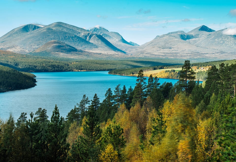
225 kilometers across Ringebufjellet, through Rondane and Dovrefjell.
A Long-Distance Trail
More and more people want to disconnect, leave the hustle and bustle of everyday life behind, and head out into the great outdoors. Set a goal, either alone or with family and friends, and complete SAGA your own way. Create your own story.
The entire route follows the Norwegian Trekking Association's (DNT) marked trails, with accommodation in serviced and self-service cabins. This allows you to pack light, as there is no need to carry a tent, sleeping bag, and no more than the food you will need to eat that day.. Once you have completed the entire route, you will earn your place in our Hall of Fame.
Map
Thorough planning is key. It is important to obtain the correct hiking maps for SAGA before you set out. Maps can be purchased at the Hiking Centre in Storgata 3 or via our online store.
The required maps for SAGA are:
Hiking map Øyer–Lillehammer (1:50,000)
Hiking map Ringebu (1:50,000)
Hiking map Rondane South (1:50,000)
Hiking map Rondane Nord (1:50,000)
Hiking map Dovrefjell, Snøhetta (1:50,000)
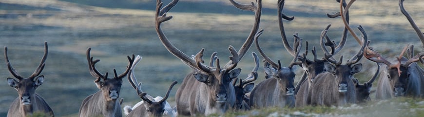
Be considerate of the wild reindeer on a trip
The wild reindeer's habitats are under pressure. This is how you can pay attention if you are in a wild reindeer area.
220 kilometers across Ringebufjellet, through Rondane and Dovrefjell. The entire route follows the Norwegian Trekking Association's (DNT) staked winter trails, with accommodation in serviced and self-service cabins.
In winter, the time required for each stage will vary considerably depending on the weather, snow conditions, and whether the trails have been freshly groomed or tracked.