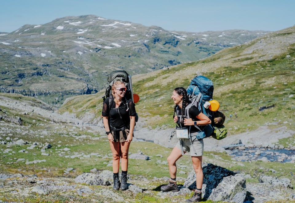
Skarvheimen is situated midway between the Hardangervidda and Jotunheimen mountain plateaus. This hiking region offers both short and multi-day routes across high mountain plateaus and down into deep valleys. The area is accessible via public transportation and features an extensive network of DNT cabins and marked trails.
Medvind – The Mountain Route to Aurlandsdalen
A point-to-point itinerary crossing from Eastern Norway into the Vestland region. The route navigates the distinct canyon landscapes and steep terrain of the Aurlandsdalen valley toward the fjord.
Distance: 49.6 km Duration: 3 days Difficulty Grade: Demanding Starting Point: Finsehytta Ending Point: Vassbygdi
Four-Day Circuit of Skarvheimen
This loop itinerary traverses central Skarvheimen, connecting four staffed mountain lodges in high-alpine terrain characterized by a mix of plateau and mountain structures.
Distance: 53.1 km Duration: 4 days Difficulty Grade: Moderate Starting Point: Storestølen Ending Point: Geiteryggtunellen
Long-Distance Trek Through Skarvheimen
A point-to-point route traversing the entirety of Skarvheimen from north to south, passing through Hallingskarvet National Park and connecting multiple backcountry areas.
Distance: 70.4 km Duration: 5 days Difficulty Grade: Demanding Starting Point: Skarvheim (Hemsedalsfjellet) Ending Point: Finsehytta
MASSIV Signature Trail: Stage 3 (Skarvheimen)
The third stage of the official long-distance MASSIV trail. The route features varied topography, including peaks, mountain ridges, and deep valleys, utilizing both staffed lodges and self-service cabins.
Distance: 103.6 km Duration: 6 days Difficulty Grade: Demanding Starting Point: Slettedalsbue Ending Point: Finsehytta
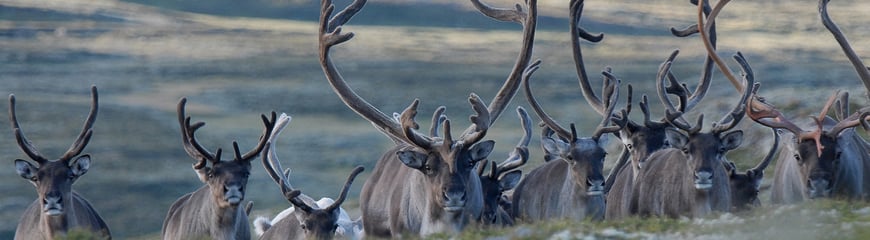
Show Consideration for Wild Reindeer
The natural habitats of Europe’s wild reindeer are facing unprecedented fragmentation. As a hiker, understanding how to minimize your impact is essential when traveling through these vulnerable alpine ecosystems.
A classic route in Skarvheimen designed for a weekend itinerary, connecting the main staffed DNT lodges in the central network.
Distance: 42.4 km Duration: 3 days Difficulty Grade: Moderate Starting Point: Iungsdalshytta Ending Point: Finsehytta
3-Day North-to-South Mountain Trek
A shorter multi-day route through Skarvheimen, transitioning from open mountain plateaus into deep, vegetated valleys.
Distance: 42.5 km Duration: 3 days Difficulty Grade: Demanding Starting Point: Skarvheim Ending Point: Storestølen
Three-Day Trek in Hemsedal
A point-to-point route through the quieter mountain areas of Hemsedal. The itinerary includes an overnight stay at the smaller self-service DNT cabin, Kljåen, with public transportation available at both the start and endpoints.
Distance: 39.6 km Duration: 3 days Difficulty Grade: Demanding Starting Point: Bjøberg Ending Point: Grindaheim (Vang)
Estimating Hiking Time
Estimated hiking times on marked mountain trails are based on an average adult carrying a standard 10 kg backpack:
Horizontal Speed: 3.5 km per hour (approximately 17 minutes per km).
Ascent: Allow an additional 15 minutes per 100 meters of elevation gain.
Rest Breaks: Add 1 hour of total break time for every 5 hours of hiking for adults.
Children under 10: Double the calculated adult hiking time.
Children over 10: Add 50 percent to the calculated adult hiking time.
Walking time for an adult is therefore calculated as follows:
Number of km x 17.14 + (15 x every hundred meters of elevation) / 60
Example: A 2.8 km hike with an 85-meter elevation gain (rounded to 100 meters) requires approximately 1 hour of active walking time.
2.8 x 17.14 + (15 x 1) / 60 = 1.05
= 1 hour walking time
Packing list for mountain hikes in the summer
Are you wondering what to take with you on a summer trip in the mountains? DNT's recommended packing list gives you an overview.