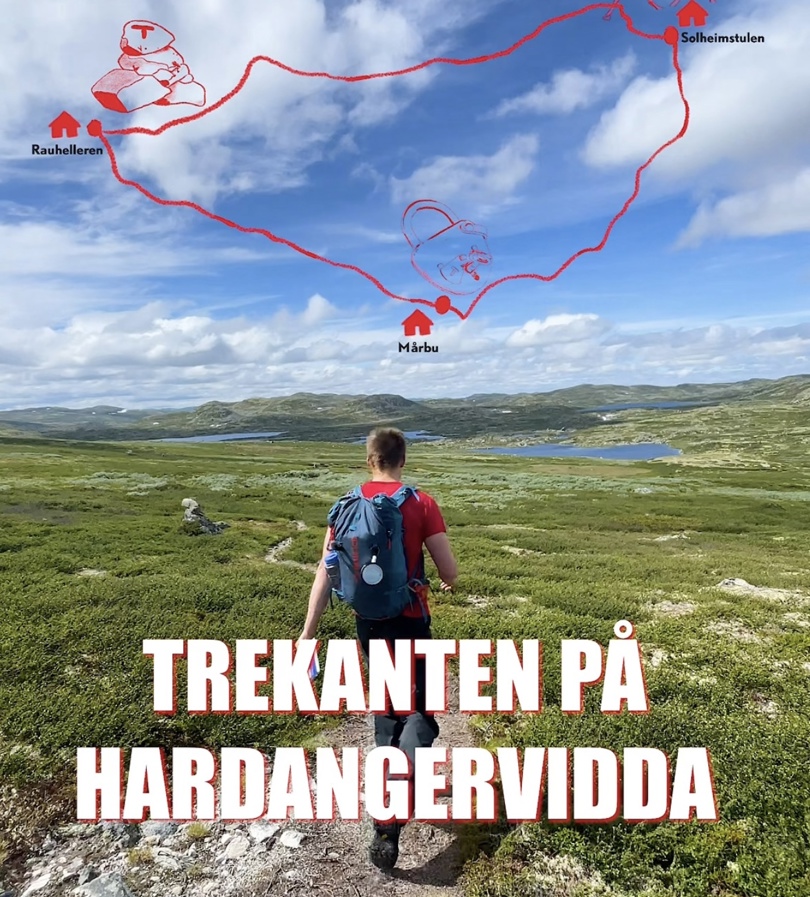
Experience the beauty of Hardangervidda on a classic loop between three of DNT's most welcoming serviced lodges: Solheimstulen, Mårbu, and Rauhelleren.
This magnificent hike offers four days of friendly hospitality, excellent food, and authentic mountain experiences. Below you will find all the information you need to plan your adventure.
Trip Facts:
Length: 72.5 km
Duration: 4 days
Total Ascent: 1,048 m
Season: July – September
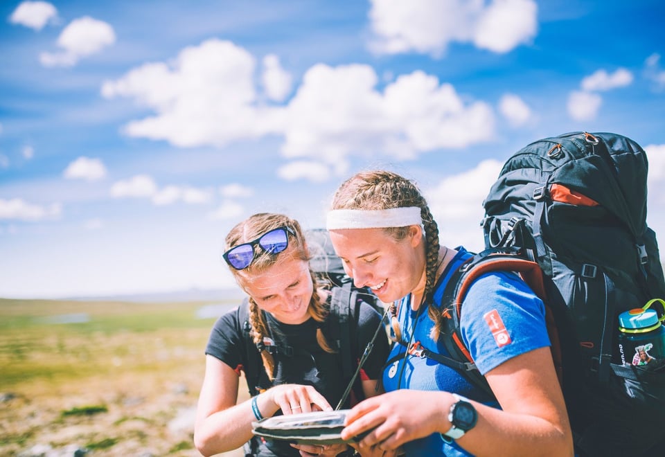
Need some inspiration before planning your trip?
This is what Trekanten on Hardangervidda can look like
Distance: Approx. 19 km Estimated Time: 5–6 hours Elevation Gain: Approx. 400 m
The trek begins at Solheimstulen, located in the southeastern part of Hardangervidda. From here, you will hike into welcoming mountain terrain where the trail winds through rolling valleys and vast plains, offering beautiful views of the plateau and distant lakes. You will finish the day at Mårbu, a cozy lodge idyllically situated by Lake Mårvatnet, where a hot meal and a warm bed await.
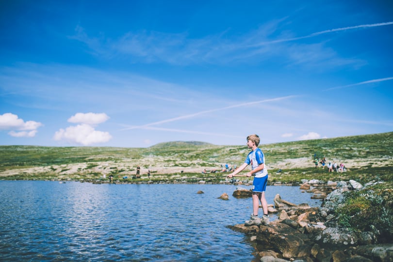
Bring a fishing rod and try your luck in the Gjeitvassdalen valley between Mårbu and Rauhelleren.
This stage takes you deeper into the very heart of Hardangervidda. The trail guides you through a shifting landscape of wide-open plains and low mountain ridges. You will cross several scenic streams along the way. Your destination is Rauhelleren, a popular serviced lodge renowned for its warm atmosphere and excellent local food.
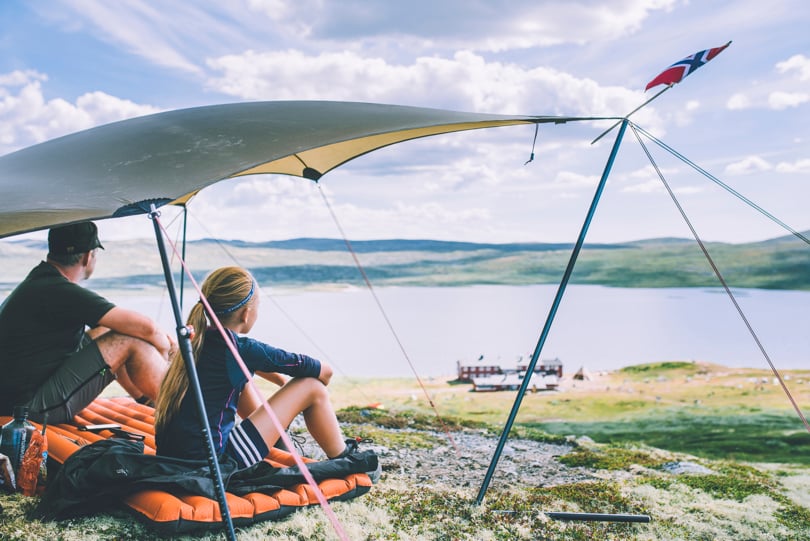
Tip: Bring a fishing rod! Try your luck in the Gjeitvassdalen valley between Mårbu and Rauhelleren. Don't miss the mountain magic just above the lodge, offering stunning views overlooking Lake Langesjøen.
Hiking magic on the hill above Rauhelleren with a view of Langesjøen.
Day 3 & 4: Rauhelleren back to Solheimstulen
Distance: Approx. 32 km Estimated Time: 9 hours Terrain: Varied with some sustained climbs
The final leg brings you all the way back to Solheimstulen. This is a long day's march, and covering over 30 km in a single day can be physically demanding for most hikers.
Practical info for the long final stage: Our estimated time is based on a standard mountain walking pace of 3.5 km/h. While this route can be completed by both fit children and seniors, it does require prior hiking experience from both children and parents. We highly recommend testing your endurance with similar distances in the lowlands before attempting this mountain stage.
Safety Note: Approximately 14 km before reaching Solheimstulen, you will pass Lake Skarsvatnet, where you'll find the Ulvelilægeret emergency shelter. During the hiking season, DNT upgrades this shelter with comfortable sleeping mats and extra safety equipment—perfect if you need an extended break before tackling the final 14 km stretch.
Welcome to Hardangervidda East this summer!
Practical Information
Accommodation & Meals
All three lodges are fully staffed during the summer season. They serve a hearty breakfast, a traditional three-course dinner, and allow you to pack a lunchtime sandwich box (matpakke) and fill your thermos for the day ahead.
Maps & Navigation
The trails are well-marked with DNT's signature red "T"s. However, you should always carry a physical map and compass (or a reliable GPS) for safety. For this trek, we recommend the paper map RAUHELLEREN 1:50,000 from Nordeca.
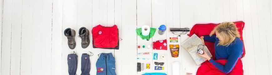
Packing list for summer mountain hikes
Wondering what to bring on a summer trek in the mountains? DNT's recommended packing list gives you the full overview.
Solheimstulen is easily accessible by car, with a year-round road leading straight to the courtyard. The best part about the Triangle Trek is that it starts and ends in the exact same place, making logistics completely hassle-free. Solheimstulen offers a large day-parking area for visitors (approx. NOK 70 per day, payable via the Vipps app).