Need to refresh your knowledge of map reading and what different symbols represent? Here's a brief guide to essential map colors and symbols.
Maps are a form of coding language, and they use symbols and colors to represent features in the landscape.
When we are going to read maps, we need to understand the symbols, just as we need to know letters to read a book. Colors are more distinct on orienteering maps, but the basic principle is the same.
Map symbols are explained in the legend of every map, but it may be a good idea to learn this:
Blue represents water (lakes, rivers, marshes)
Black represents solid features (houses, stones)
Yellow represents open areas (easy terrain)
Green represents vegetation (dense forest and difficult terrain)
Brown represents elevation (indicate elevation and terrain features)
White represents typical forest
Scale
A map's scale indicates how much the map has been reduced in size.
If the scale is 1:50,000, it means that the map has been reduced 50,000 times. In other words, 1 cm on the map will be 50,000 cm, i.e. 500 m, in the terrain.
Orienteering maps for forests and fields are on a scale of 1:10,000 and 1:15,000, while the hiking maps are on a scale of 1:25,000 or 1:100,000.
All of Norway is covered by 1:50,000 scale maps, so you can use a map and compass wherever you are.
Tips:
Cover the last two zeros of the scale with your finger. This will show you how many meters 1 cm on the map represents in the terrain.
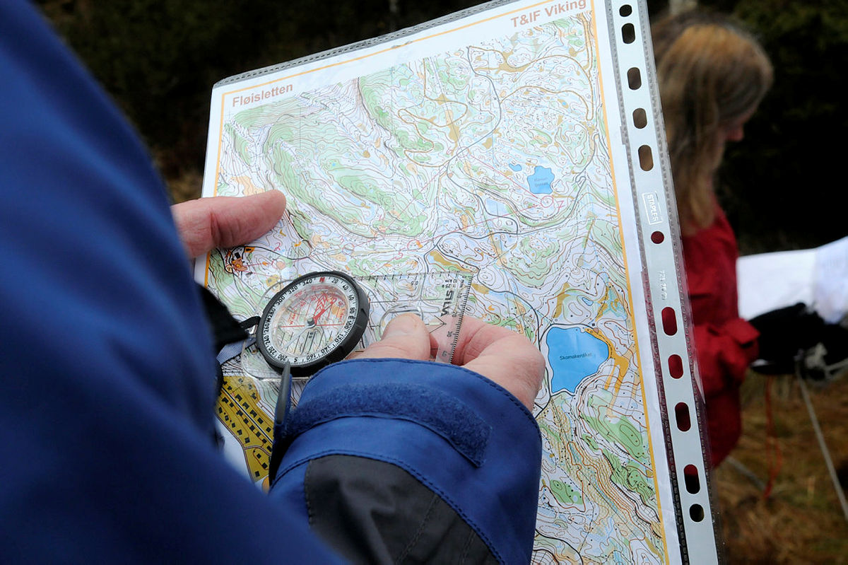
Orienting the map
To determine where you are and where to go to get from one point to another, you first have to orient the map. That is, holding the map so it aligns with the terrain. The top of the map (north) should point toward true north, meaning the top of the map should align with the direction the red compass needle points.
Place the compass flat on the map so that the direction-of-travel arrow on the compass is parallel to the meridians (north-south grid lines), pointing toward the north of the map.
Then rotate the entire map (with the compass on it) until the magnetic needle aligns with the orienting arrow in the compass housing.
Now the map is oriented. Alternatively, you can orient the map by aligning it with visible terrain features such as roads, rivers, railways, power lines, or lakes.
Photo: Trond J. Hansen
How to use a map and compass
Want to learn more? Here is a brief introduction to the use of a map and compass. Try and fail, and try again.